Factoring weather into your planning
A broad look at Australia's climate calendar gives you an idea of weather patterns. You tend to go north or central Australia in winter and head south in summer.
You could fry an egg on the wing at Tibooburra in January or get blown off the map at Cape York over Christmas. November is going to be far more appealing in Tasmania than Birdsville. And I'd plan a winter visit to Darwin any day rather than an icy July welcome at Jindabyne.
The notorious wet season throughout northern Australia, between October and March, is uncomfortably hot and prone to wildly unstable weather.
Our decision to conduct this safari in August worked very well. We based our choice on:
- high probability of it being one of the most reliable VFR weather windows
- avoiding late winter winds
- the onset of the heat and instability of the monsoon season of the tropical north.
Practical example
At every stage of your safari it's important to understand the weather forecast not just today and tomorrow, but for the next few days.
Spend time becoming familiar with the BOM website. Study their four-day MSL Pressure Prognosis chart to see how the weather patterns heading your way may impact your journey.
In the blazing sunshine and calm winds at Mt Isa, our pilot Catherine took some time discussing the longer-range forecast with the crews.
The onwards route was to take them north from Mt Isa to Normanton to refuel, then Karumba for an overnight stay. The following day they would travel to the west coast of Cape York to Kowanyama and on to Horn Island.
The following day's forecast was good, but the day after that promised some unsettled weather.
They discussed their options, looking at where they could stop overnight en route if necessary, or change their route to avoid the weather.
They looked at refuelling options in each of the scenarios and researched accommodation availability as well.
As it turned out, they got as far as Kowanyama and decided that the VFR window for reaching Horn Island was now reducing.
They elected to cut that waypoint out of the itinerary and head straight across to the east coast to Cooktown.
This meant stopping at the tiny outpost of Laura for fuel. This involved phone calls to the drum refueller to confirm he and his fuel supply were both there and available. They also discussed the condition of the strip and local current weather.
Always be ready to revise your itinerary if weather deteriorates on your forward route.
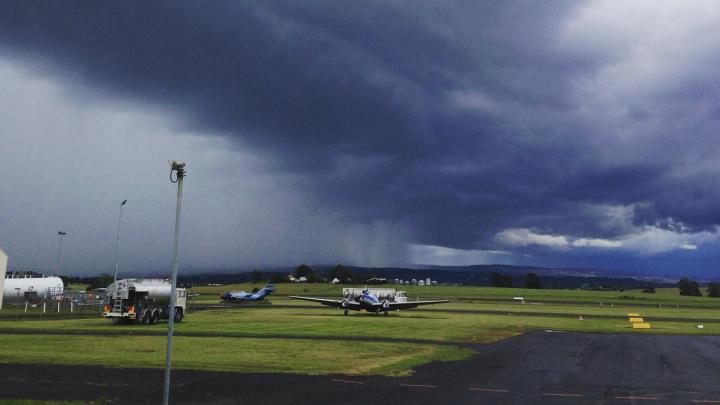
View of aerodrome with clouds and looming storm
Passenger comfort
If you are confident of clear skies ahead on your journey, it's perhaps time to consider the fine print on your forecast.
If you see high temperatures and strong headwinds on the agenda, try and work your timing. This will help you avoid flying in hot weather at the end of a long day flying.
These conditions are common in the tropical north is particularly prone and can produce relentless turbulence. This can be tiring for the pilot and very uncomfortable for the passengers.
As a rule of thumb, flying in the morning with cooler air is more comfortable than the build-up of heat and instability common on hot days.
You will glean vital information from the Graphical Area Forecast (GAF). You can find it in the NAIPS platform (head to NAIPS/Charts/Chart Directory. The GAF is the first option.
Once you select the area applicable to your flight, you can access data on:
- weather
- cloud
- visibility
- icing
- turbulence
- freezing levels.
You can also find clarification or an update on any part of a GAF by talking to the meteorologist who wrote it at BOM. Call the phone number in the bottom left corner of the Remarks section of the GAF.
Tips and advice
- Study the GAF and GPWT (Grid Point Wind and Temperature) forecast like your life depends on it. TAFs are important, but they don't give you en route weather
- Weather systems are mobile. It's important to recognise that forecast conditions may change over time
- If your EFB doesn't have the function to overlay this electronically, draw a pencil line on your PCA to show where that front or line of weather is going to be and note the time next to it
- Recognise early if you don't have VFR conditions ahead and do something about it
- Ask ATC for help if needed. They can search for areas for you to divert to that offer VMC
- Treat AWIS and AWIB information with care. It is only as accurate as the equipment which records it allows, and conditions like cloud base, mist and fog can change quickly. Always keep checking the AWIS for current conditions as you approach your destination
- Remember METARs and SPECIs are only one-time snapshots! Use them in conjunction with the current TAF
- Don't let your enthusiasm to complete a flight overshadow your unbiased assessment of the weather
- Read through AIP GEN 3.5 and give yourself a refresher on all the terms and codes in an aviation forecast