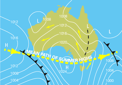
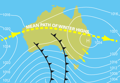
The climate of south-west Australia is largely of Mediterranean type with mostly cool wet winters and warm to hot dry summers. It is useful to consider flying conditions from a ‘winter’ (May to September) and a ‘summer’ (November to March) perspective. There is a transitional period between the 2 seasons, with October and April being the transition months.
Summer
Summer, with its long periods of clear skies, presents the best flying conditions; however, hazards may be present in the form of:
- thunderstorms
- tropical cyclones (occasionally)
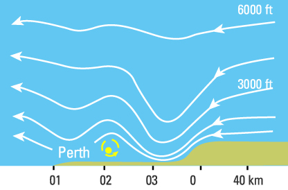
- mechanical turbulence (particularly near the Darling Scarp)
- dust storms
- low cloud (occasionally), particularly coastal.
- smoke (from bushfires).
Winter
Adverse flying conditions in winter are usually associated with one of the following systems:
- orographic lifting of low-level moist air by the terrain leading to extensive low cloud
- cold fronts
- fog, particularly on the days following the passage of a cold front
- cut-off lows
- cloud bands
- localised convergence of moist air near the coast, giving rise to low cloud and drizzle
Rotor formation
The diagram above depicts the disturbed flow and rotor formation between the Darling Scarp and the coast.


